MX103

mosaic High Precision GNSS Receiver

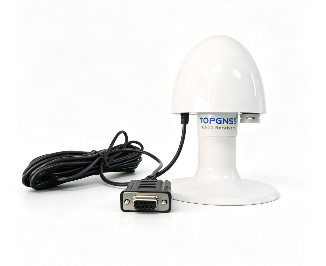
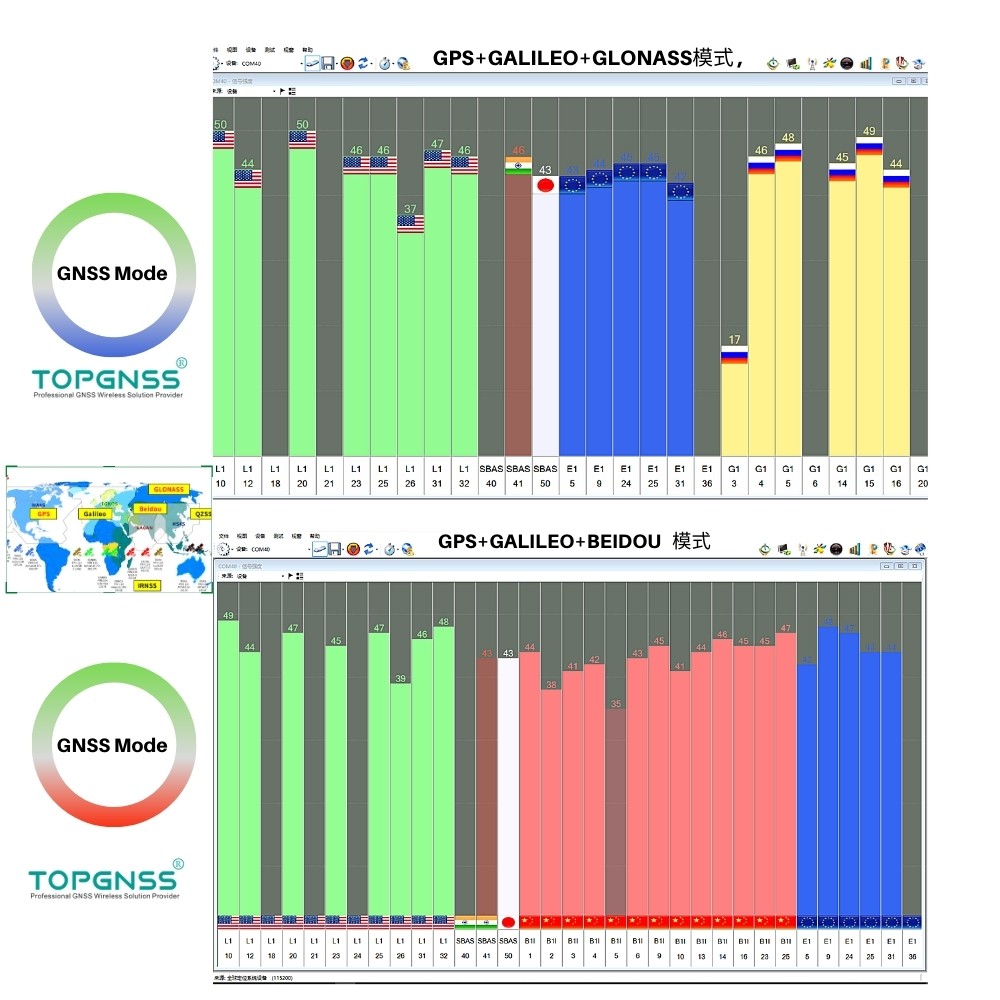
TOPGNSS MX103 high-precision GNSS module receiver adopts standard GNSS working mode and supports simultaneous reception of GPS, GLONASS and GALILEO satellite systems. Featuring RS232 serial port communication level, it fully meets the requirements of vehicle-mounted and marine industrial applications. With simple installation, flexible operation, and easy integration and maintenance, it supports multi-constellation and quad-band GNSS signal tracking with a full-field satellite view. The device outputs complete raw data including positioning measurements and is compatible with Galileo HAS positioning service. It delivers best-in-class RTK centimeter-level positioning accuracy, industry-leading ultra-low power consumption, and advanced GNSS+ algorithms, while being optimized for automated assembly for easy integration.

  • Model:: MX103
  • Operating Voltage:: 5.0V, 5.0V can be customized
  • Operating Current:: 80mA
  • Connector Type:: DB9,Support customization

Parameter Item
Specification
Hardware Channels
789 channels, tracking all visible satellites simultaneously
Supported Systems & Bands
GPS: L1C/A, L2C, L2PY, L5 GLONASS: L1CA, L2CA, L2P, L3 CDMA BDS: B1I, B1C, B2a, B2I, B3I Galileo: E1, E5a, E5b, E6 QZSS: L1C/A, L1C, L2C, L5
Positioning Modes
Single-point positioning, DGNSS differential positioning, multi-system RTK rover positioning
Data Output
Supports full raw observation data output

Parameter Item
Specification
RTK Horizontal Accuracy
0.6cm + 0.5ppm
RTK Vertical Accuracy
1cm + 1ppm
RTK Initialization Time
7 seconds
Velocity Accuracy
3cm/s
Single-point Accuracy
Horizontal 1.2m / Vertical 1.9m
DGNSS Accuracy
Horizontal 0.4m / Vertical 0.7m

Parameter Item
Specification
Max Position Update Rate
20Hz
Max Raw Data Output Rate
20Hz
System Latency
<10ms
PPS Timing Resolution
1.4ns
Event Marker Accuracy
<3ns
Default Output Refresh Rate
1Hz


Parameter Item
Specification
Hardware Interfaces
RS232
Protocols
NMEA0183, RTCMv3.x, Septentrio SBF
Default Baud Rate
115200
Output Level
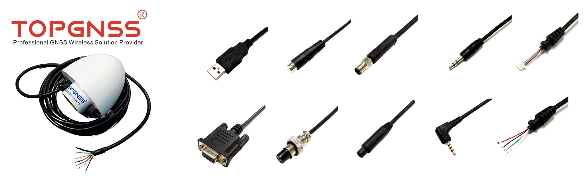
Default RS232, customizable TTL, USB, RS485, RS422
Working Voltage
Default 5V, customizable 9V~36V wide voltage input
DB9 Pin Definition (Female)
2TX, 3RX, 5GND, 9VCC


Parameter Item
Specification
Ingress Protection Rating
IP67
Power Consumption
Typical 0.44W, Max 0.57W
Operating Temperature
-40℃ ~ +85℃
Storage Temperature
-55℃ ~ +85℃
Humidity
5%~95% non-condensing
Vibration Standard
IEC 60721-3-5 5M3
Certifications
CE, FCC, RoHS

Parameter Item
Specification
Housing Material
Waterproof mushroom housing with ABS plastic base, dustproof, UV-resistant and aging-resistant
Cable Specification
Standard DB9 female connector, total cable length 5 meters, plug-and-play


TOPGNSS  GNSS Receiver /GPS MOUSE                                        TOP103              Size: 87*75mm
Receiving Frequency bandGNSS L1, (GPS+GLONASS+GALILEO)Or (GPS+BEIDOU+GALILEO)Receiving channel72CH
Direction<0.5 DegreesRate<0.1m/s
Timing accuracy50 nsReference coordinate systemWGS-84
Maximum altitude50000MMaximum speed500 m/s
Acceleration<=4gTracking sensitivity-167dBm
Capture the sensitivity-167dBmStandard clock pulse0.25Hz-1KHz
Location update rate1Hz-15Hz(default 1Hz,Only GPS mode supports 20HZ)The start up time32(typical)

Port interface(default)

RS232 port interface(default)

RS232 port interface(default)

Customizable UART/TTL, USB, RS485, RS422

Warm start time28(typical)

Hot start

1(typical)AGPS3s

Output

NMEA 0183 V4.1(GNGGA,GGSA,GNGSV,GNRMC,GNVTG,GNGLL)protocol,UBX

Electrical interface

Wide voltage range: the main power supply 3.3-5V, Owned RTC Power

Data rate

9600bps(default) (optional: 1200,2400,4800,19200,38400,57600,115200,230400,460800,921600)

Cable length

5.0 meters(Support 2m, 3m, 10m, 15m, 20m customization)C/A Code,1023MHz code stream

Connector

DB9 female (support customization)

Positioning performance

<2.0M(Autonomous)(50%) <1.5M(SBAS)

Fixing method

With fixed bracketWater release ratingIP67

Normal working conditions

ParametersMinStandardMax
The power supply voltage(V)7.012.024.0
Working temperature(ºC)-40--85
Working current(mA)3545


55


Connector DB 9 Pin Out:

DB9 female Pin Description:

Interface

PIN

PIN Name

I/0

Description

DB9  Female

2

TX

I

RS-232   Serial Data Output

3

RX

O

RS-232   Serial Data INput

5

GND

I

Ground

9

VCC

G

DC 5.0V supply input,Typical:5.0V

External power supply:=+5.0vDC      Pin=2+GPS Tx    Pin 3=GPS Rx      Pin 5=GND


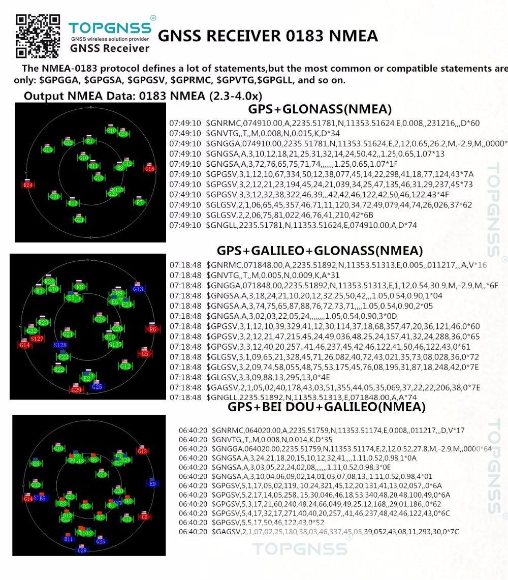
Output NMEA0183   protocol sample:


XXGGA,XXRMC,XXGSV,XXGSA,XXVTG,XXGLL

Configured GNSS

Talker ID

GPSSBAS,QZSS

GP

GLONASS

GB

BeiDou

GB

Galileo

GA

Any combination   of GNSS

GN

06:26:28  $GNRMC,062628.00,A,2235.51231,N,11353.49967,E,0.005,,090721,,,D,V*05

06:26:28  $GNVTG,,T,,M,0.005,N,0.010,K,D*3C

06:26:28    $GNGGA,062628.00,2235.51231,N,11353.49967,E,2,12,0.73,26.6,M,-2.9,M,1.0,3344*41

06:26:28  $GNGSA,A,3,02,20,12,17,09,19,05,25,13,50,,,1.83,0.73,1.68,1*01

06:26:28    $GNGSA,A,3,69,83,68,,,,,,,,,,1.83,0.73,1.68,2*09

06:26:28    $GNGSA,A,3,09,12,04,36,25,11,24,,,,,,1.83,0.73,1.68,3*08

06:26:28  $GNGSA,A,3,08,11,07,14,13,34,10,,,,,,1.83,0.73,1.68,4*0B

06:26:28    $GPGSV,4,1,14,02,47,347,43,05,37,245,42,06,42,037,41,09,22,053,37,1*6C

06:26:28    $GPGSV,4,2,14,11,48,352,45,12,34,280,40,13,14,183,31,17,27,132,39,1*62

06:26:28  $GPGSV,4,3,14,19,49,121,42,20,58,277,43,25,12,307,36,28,,,35,1*54

06:26:28    $GPGSV,4,4,14,41,46,237,43,50,60,149,41,1*6D

06:26:28    $GPGSV,2,1,07,05,37,245,42,06,42,037,44,09,22,053,40,11,48,352,46,6*66

06:26:28    $GPGSV,2,2,07,12,34,280,40,17,27,132,38,25,12,307,37,6*52

06:26:28  $GPGSV,1,1,01,40,20,257,,0*52

06:26:28    $GLGSV,2,1,07,68,44,033,46,69,76,166,47,73,07,231,33,74,08,276,32,1*76

06:26:28    $GLGSV,2,2,07,82,16,104,33,83,43,060,32,84,29,343,35,1*49

06:26:28    $GLGSV,2,1,06,68,44,033,39,69,76,166,40,73,07,231,31,82,16,104,31,3*7B

06:26:28    $GLGSV,2,2,06,83,43,060,35,84,29,343,38,3*78

06:26:28  $GLGSV,1,1,01,70,17,202,,0*49

06:26:28    $GAGSV,3,1,09,04,54,083,49,09,45,175,47,11,50,008,46,12,28,076,41,2*74

06:26:28    $GAGSV,3,2,09,14,43,320,52,19,09,040,33,24,18,196,41,25,28,252,44,2*73

06:26:28  $GAGSV,3,3,09,36,22,312,41,2*4F

06:26:28    $GAGSV,3,1,09,04,54,083,40,09,45,175,41,11,50,008,41,12,28,076,31,7*7E

06:26:28    $GAGSV,3,2,09,14,43,320,46,19,09,040,26,24,18,196,36,25,28,252,36,7*72

06:26:28  $GAGSV,3,3,09,36,22,312,38,7*44

06:26:28  $GAGSV,1,1,02,02,12,302,,05,03,203,,0*71

06:26:28    $GBGSV,2,1,08,07,41,190,41,08,48,354,44,10,51,221,43,11,47,092,43,1*78

06:26:28    $GBGSV,2,2,08,13,46,322,45,14,71,044,46,16,25,166,39,34,28,112,40,1*7D

06:26:28  $GBGSV,2,1,08,06,28,161,43,07,41,190,44,08,48,354,47,10,51,221,45,3*78

06:26:28    $GBGSV,2,2,08,11,47,092,48,13,46,322,47,14,71,044,48,16,25,166,42,3*70

06:26:28    $GBGSV,3,1,09,01,47,123,,03,65,189,,04,33,110,,05,24,255,,0*7B

06:26:28    $GBGSV,3,2,09,05,24,255,,09,12,183,,12,04,121,,23,06,229,,0*75

06:26:28  $GBGSV,3,3,09,23,06,229,,0*40

06:26:28    $GNGLL,2235.51231,N,11353.49967,E,062628.00,A,D*78

06:26:29    $GNRMC,062629.00,A,2235.51231,N,11353.49967,E,0.008,,090721,,,D,V*09

06:26:29  $GNVTG,,T,,M,0.008,N,0.015,K,D*34

06:26:29    $GNGGA,062629.00,2235.51231,N,11353.49967,E,4,12,0.73,26.6,M,-2.9,M,1.0,3344*40


(1) Possible values for status: V = Data invalid, A = Data valid

(2) Possible values for quality: 0 = No fix, 1 = Autonomous GNSS fix, 2 = Differential GNSS fix, 4 =

RTK fixed, 5 = RTK float, 6 = Estimated/Dead reckoning fix

(3) Possible values for navMode: 1 = No fix, 2 = 2D fix, 3 = 3D fix

(4) Possible values for posMode: N = No fix, E = Estimated/Dead reckoning fix, A = Autonomous

GNSS fix, D = Differential GNSS fix, F = RTK float, R = RTK fixed

Flags in NMEA 4.10 and above

(1) Possible values for status: V = Data invalid, A = Data valid

(2) Possible values for quality: 0 = No fix, 1 = Autonomous GNSS fix, 2 = Differential GNSS fix, 4 =

RTK fixed, 5 = RTK float, 6 = Estimated/Dead reckoning fix

(3) Possible values for posMode: N = No fix, E = Estimated/Dead reckoning fix, A = Autonomous

GNSS fix, D = Differential GNSS fix, F = RTK float, R = RTK fixed


TOPGNSS Support customized GNSS   receiver GNSS chip specifications:


GNSS chips

Brand

   Chip Model

Remarks


U-blox

UBX-M8030-KT

UBX-G7020-KT

UBX-G6010-ST

GNSS L1


MTK

MT3335

MT3333

MT3331

MT3337

Support custom NMEA data encryption


ALLYSTAR

HD8040

HD8020

GNSS:L1+L5


SIRF

SIRF4

SIRF5

GNSS:L1


TOPGNSS GNSS Receiver Accept custom   type:

GNSS mode, special data, structure,   size, logo, cable length, connector specification, installation and fixing   method.


If you have other special   requirements, please feel free to contact us.

      info@topgnss.com


TOP103 GPS receiver connector specifications

Primary CompetitiveAdvantages

         Small Orders Accepted

Support sample purchase and small batch   customization

         Quality Approvals CE,FCC,ROHS)

         Servicerapid mass customization OEM / ODM

         Reputation (TOPGNSS)

Shipping   Information

Lead Time:3-30days

FOB Port:Shen Zhen China

Payment Details

Payment Method: L/C or T/T in Advance

Main Export   MPayment Details

         Asia

         Australasia

         Central/South America

         Eastern Europe

         North America

         Western Europe

         Mid East/Africa

Transportation   logistics

FedEX

UPS

DHL

Tips:Support guests to send goods using   their signed logistics express

FAQ

Q: Can I get a sample of GNSS receiver?

A: Yes, you can also purchase the samples you need through our online store. When purchasing in bulk, we can refund the sample cost.


Q: Is the GNSS receiver 100% assembled in stock?

A: No, all GNSS antennas will be reassembled according to your order (including samples).


Q: What is the delivery time?

A: 3-5 working days for samples, 10-15 working days for quantities below 5K.


Q: Can I use my own LOGO or design on the product?

A: Yes, the logo and mass production design can be customized.


Q: What is the payment term?

Answer: T/T, Paypal, Western union, etc.


Q: Can I visit your company?

A: Of course, you are welcome at any time.


Q: How long is the warranty period?

A: One year for antennas, half a year for assembling cables and connectors


Feedback

首页
产品
联系